

Full-Constellation Tracking: Strong Signal & High-Quality Data
- Supports 1408 channels
- New GNSS SoC chip: Low power consumption,extended battery life.
- Advanced technology: Advanced multi-frequency anti-interference and adaptive filtering technology ensures strong signal reception, high-quality data and excellent accuracy.
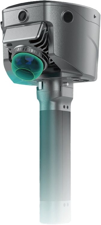
Innovative Industrial Design
- Compact & lightweight for easy handling.
- Metal lock mechanism securely connects the device and battery handle, ensuring stable operation.
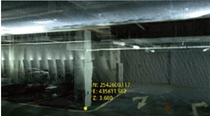
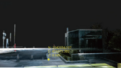
Contactless Measurement
- Utilizing laser point cloud data and image data provides real-time acquisition of rich geospatial information efficiently and conveniently.
- This technology greatly expands the application scope of GNSS, allowing measurements in areas like under bridges, culverts, and enclosed spaces, ensuring efficient and safe operations.
- Leveraging Android’s high-performance laser point cloud and image processing technology, users can simply take a photo to obtain coordinates of multiple points on the handheld software. With an accuracy better than 5cm within a 15m working distance, it doubles working efficiency.
Unified Coordinate Framework
- RTK + SLAM Fusion: V700S delivers real-time centimeter-level positioning outdoors while automatically aligning point cloud data, ensuring unified coordinate output (BLH/NEZ).
- Control-free scanning: V700S requires no control points, allowing users to scan freely without returning to previous locations – dramatically improving on-site efficiency.
Laser Reverse Positioning Technology:
Precision Measurement without Signal
Hi-Target’s innovative Laser Reverse Positioning Technology enables seamless cross-environment measurement. Outdoors, the high-precision RTK module delivers centimeter-level accuracy. In GNSS-denied areas like under bridges or eaves, the system automatically switches to laser-based positioning, ensuring uninterrupted data capture.
Volume Calculation
Through laser point cloud data, rich three-dimensional data of ground objects can be obtained in real time. By leveraging high-performance Android-based processing technology, quantitative results can be derived efficiently and conveniently.
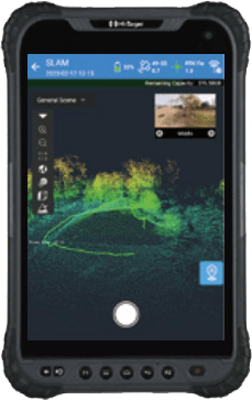
8-INCH ROBUST TABLET
- 2.0GHz, 8 cores high-speed processor
- 6+128GB large memory
- 8200 mAh high capacity battery
- Based on Android 10, more smooth operation
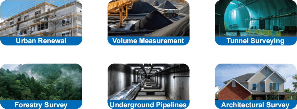
Applications
Software
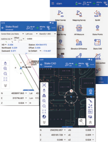
Hi-Survey Field Software
- High-performance laser point cloud & image processing engine for real-time solutions and visualization.
- Precision heat map display allows users to monitor accuracy in real time.
- Integrates industry-leading CAD & real-scene engines for an intuitive, visual measurement and layout experience.
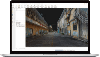
Office Software for Post-processing
- Hi-LiDAR software refines real-time data, delivering point clouds with sub-2 cm thickness and <1 cm relative measurement precision.
- Automated excavation analysis: Calculates over/under-excavation for tunnel sections, enabling construction progress tracking and validation.
- Advanced section visualization & drafting: Supports horizontal/vertical section views, aiding in renovation planning for older buildings with precise architectural measurements.
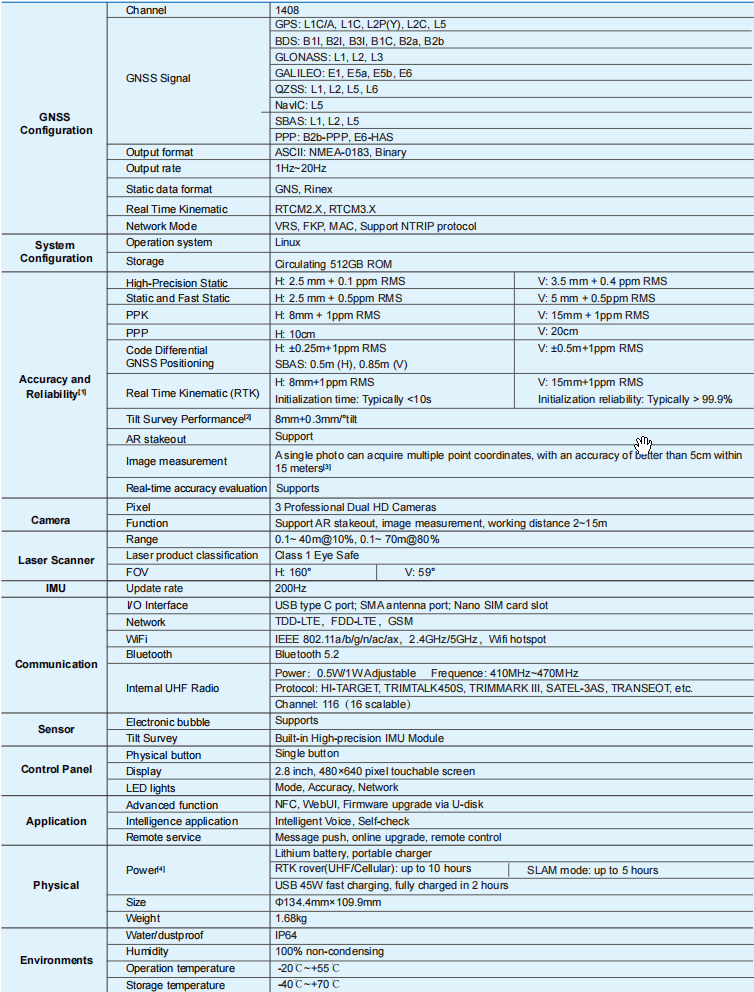
TECHNICAL SPECIFICATIONS

Reviews
There are no reviews yet.